Category: Trails
-
Chippewa Ski Trail
Read more: Chippewa Ski TrailAddress: 46.5055556,-89.9661111 Countie(s) trail is located in: Gogebic Trail Type(s): Downhill Skiing Trail Measurement: The Chippewa Ski Trail is a trail located in Michigan. References and More Info
-
Christmas Trail
Read more: Christmas TrailAddress: Countie(s) trail is located in: Alger Trail Type(s): Snowmobile Trail Measurement: 7 Miles Trail Distance: 7 Miles Trail Description: The Christmas Trail links the North Hiawatha Trail with the towns of Christmas and Munising. Services available in both of these towns include phone, fuel, groceries, lodging, taverns, restaurants, and snowmobile repair. Munising also has…
-
Canada Lakes Pathway
Read more: Canada Lakes PathwayAddress: 46.27728, -85.48842 Countie(s) trail is located in: Luce Trail Type(s): Camping <> Cross Country Skiing <> Fishing <> Hiking <> Mountain Biking <> Canoe/Kayak Trail Measurement: 14 Miles Trail Distance: 14 miles with 6 loops ranging from 1 mile to 7.7 miles long. Directions: Pathway Directions to Trailhead: 5.5 miles SE of Newberry via…
-
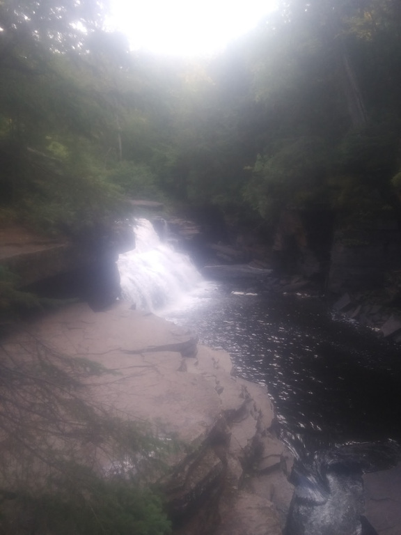
Canyon Falls Roadside Park
 Read more: Canyon Falls Roadside Park
Address: Canyon Falls Trail Highway 41 Covington, MI 49919 Countie(s) trail is located in: Baraga Trail Type(s): Hiking Trail Measurement: This small park located fourteen miles south of Baraga offers a boardwalk through a cedar swamp and a great view of the scenic Canyon Falls on the Sturgeon River. For a closer look at the…
-
Carp River
Read more: Carp RiverAddress: Countie(s) trail is located in: Chippewa Trail Type(s): Camping <> Fishing <> Canoe/Kayak Trail Measurement: 40.2 Miles Carp River is the name of several rivers in the U.S. state of Michigan. The Carp River flows through predominantly forested lands with little development along its way. Spring’s high water provides for canoeing and offers steelhead…
-
Cedar River Pathway
Read more: Cedar River PathwayAddress: 45.49987, -87.38543 Countie(s) trail is located in: Menominee Trail Type(s): ATV/ORV/OHV <> Camping <> Cross Country Skiing <> Fishing <> Hiking <> Mountain Biking <> Ski Skating <> Canoe/Kayak Trail Measurement: 8 Miles Directions: Located 8 miles north of Cedar River via M-35 and County Road 551 Trail Description: Big Cedar River – Logging…
-
Chapel Basin Area
Read more: Chapel Basin AreaAddress: Countie(s) trail is located in: Alger Trail Type(s): Hiking <> Leashed Dogs Allowed Trail Measurement: 9 Miles Several hikes are available in this area, depending on what trails you take and how long you wish to walk. The 3.0 mile trail from the Chapel parking lot to Chapel falls runs along an old roadbed.…
-
Brunos Run
Read more: Brunos RunAddress: Countie(s) trail is located in: Alger Trail Type(s): Cross Country Skiing <> Hiking <> Mountain Biking <> Snowshoe <> Motorcycle Trail Measurement: 10.1 Miles The Bruno’s Run Trail offers a 9-mile (14.48 km) loop ideal for hiking and mountain biking in spring, summer, and fall and snowshoeing in winter. Although the trail is not…
-
Buckhorn Ski Trail
Read more: Buckhorn Ski TrailAddress: , Countie(s) trail is located in: Alger Trail Type(s): Cross Country Skiing Trail Measurement: The Buckhorn Ski Trail is a trail located in Michigan. References and More Info
-
Cameron Run Ski Trail
Read more: Cameron Run Ski TrailAddress: 46.5036111,-90.0041667 Countie(s) trail is located in: Gogebic Trail Type(s): Downhill Skiing Trail Measurement: The mimeron Run Ski Trail is a trail located in Michigan. References and More Info