Category: Alger County
-
Grand Sable Dunes Trail
Read more: Grand Sable Dunes TrailAddress: Countie(s) trail is located in: Alger Trail Type(s): Hiking <> Leashed Dogs Allowed Trail Measurement: 1 Mile A 1.0 mile trail to a portion of the dunes begins at the west end of the Sable Falls parking area. The trail passes an old apple orchard and crosses a bridge over Sable Creek. It then…
-
Gemini Lake Pathway
Read more: Gemini Lake PathwayAddress: Countie(s) trail is located in: Alger Trail Type(s): Camping Cross Country Skiing Fishing Hiking Road Biking Trail Measurement: 1.5 Miles If you are at the trail and this trail needs the latitude and longitude please click the link below and add it to the Add/Edit Trail Form to give us the information. Click to…
-
Fox River
Read more: Fox RiverAddress: Fox River Michigan Countie(s) trail is located in: Luce <> Alger <> Schoolcraft Trail Type(s): Fishing <> Canoe/Kayak Trail Measurement: 36.5 Miles The Fox River system is located in Alger, Schoolcraft and Luce counties in the eastern half of Michigan’s Upper Peninsula. The mainstream of the Fox flows south from northeastern Alger County through…
-
Fox River Pathway
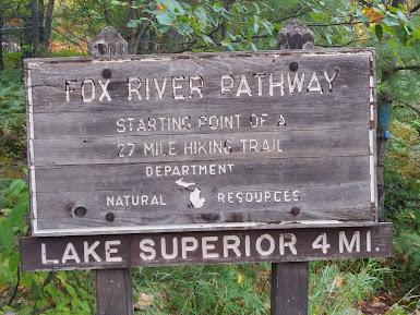 Read more: Fox River Pathway
Address: Countie(s) trail is located in: Alger Trail Type(s): Camping <> Hiking <> Road Biking Trail Measurement: 27.5 Miles Trail Distance: 27.5 Miles Directions: Pathway Directions to Trailhead: Kingston Lake SF Campground (H-58 or Kingston Lake Rd); Seney Township Campground (5 miles N of Seney on Co Rd 450) The Fox River Pathway is a…
-
Escanaba River State Forest
Read more: Escanaba River State ForestAddress: 46.15,-87.19 Countie(s) trail is located in: Menominee <> Alger <> Delta <> Marquette Trail Type(s): Cross Country Skiing <> Fishing <> Hiking <> Canoe/Kayak Trail Measurement: Escanaba River State Forest is a state forest in the central Upper Peninsula of Michigan. It includes forested lands in Alger, Delta, Marquette, and Menominee Counties. The forest…
-
Coalwood Trail
Read more: Coalwood TrailAddress: Coalwood Trail Chatham, MI 49816 Countie(s) trail is located in: Alger Trail Type(s): ATV/ORV/OHV <> Snowmobile Trail Measurement: 26.4 Miles The Coral Wood Trail is a trail located in Michigan. References and More Info
-
Chatham Ski Trail
Read more: Chatham Ski TrailAddress: 46.3613333,-86.8920944 Countie(s) trail is located in: Alger Trail Type(s): Downhill Skiing Trail Measurement: The Chatham Ski Trail is a trail located in Michigan. References and More Info
-
Chatham Trail
Read more: Chatham TrailAddress: 46.3613319,-86.89209749999999 Countie(s) trail is located in: Alger Trail Type(s): Snowmobile Trail Measurement: 1.5 Miles This is a short, well defined trail which serves as a link between the town of Chatham and the North Hiawatha Trail. Services available in Chatham include phone, fuel, groceries, and taverns. Chatham also has a 17 unit motel. The…
-
Christmas Trail
Read more: Christmas TrailAddress: Countie(s) trail is located in: Alger Trail Type(s): Snowmobile Trail Measurement: 7 Miles Trail Distance: 7 Miles Trail Description: The Christmas Trail links the North Hiawatha Trail with the towns of Christmas and Munising. Services available in both of these towns include phone, fuel, groceries, lodging, taverns, restaurants, and snowmobile repair. Munising also has…
-
Chapel Basin Area
Read more: Chapel Basin AreaAddress: Countie(s) trail is located in: Alger Trail Type(s): Hiking <> Leashed Dogs Allowed Trail Measurement: 9 Miles Several hikes are available in this area, depending on what trails you take and how long you wish to walk. The 3.0 mile trail from the Chapel parking lot to Chapel falls runs along an old roadbed.…