Tag: Trail Type: Hiking
-
Geronimo Ski Trail
Read more: Geronimo Ski TrailAddress: 46.5061111,-89.9716667 Countie(s) trail is located in: Gogebic Trail Type(s): Downhill Skiing Trail Measurement: If you are at the trail and this trail needs the latitude and longitude please click the link below and add it to the Add/Edit Trail Form to give us the information. Click to view your current location on a map.…
-
Gig Ski Trail
Read more: Gig Ski TrailAddress: 46.5036111,-89.9994444 Countie(s) trail is located in: Gogebic Trail Type(s): Downhill Skiing Trail Measurement: The Gig Ski Trail is a trail located in Michigan. References and More Info
-
Gladders Ski Trail
Read more: Gladders Ski TrailAddress: 46.505,-90.0036111 Countie(s) trail is located in: Gogebic Trail Type(s): Downhill Skiing Trail Measurement: The Gladders Ski Trail is a trail located in Michigan. References and More Info
-
Grand Island Trails
Read more: Grand Island TrailsAddress: Countie(s) trail is located in: Alger Trail Type(s): Cross Country Skiing <> Hiking <> Leashed Dogs Allowed <> Mountain Biking Trail Measurement: 23 Miles Trail Distance:43 Miles with many loops ranging from 7 miles to 23 miles long.Grand Island is located in Lake Superior, about one-half mile from the mainland community of Munising, Michigan.…
-
Grand Marais School Forest
Read more: Grand Marais School ForestAddress: Countie(s) trail is located in: Alger Trail Type(s): Cross Country Skiing <> Hiking Trail Measurement: Trail Description: The hiking and cross country ski trails are designed for daytime use. The trails run along the Sucker River that offer great views of the sandy banks and trout stream. The trail runs through a pine forest…
-
Grand Marais Ski/Snowshoe Trails
Read more: Grand Marais Ski/Snowshoe TrailsAddress: Countie(s) trail is located in: Alger Trail Type(s): Cross Country Skiing <> Hiking <> Snowshoe Trail Measurement: 10 Miles Trail Distance: 10 miles with 6 loops ranging from 2 miles to 8 miles long. Trail Description: Fee: No fee Loops/distance: 6 loops, 10 mi (16 km), classical groomed Location: H-58 W of Newberg Road…
-
Grand Sable Dunes Trail
Read more: Grand Sable Dunes TrailAddress: Countie(s) trail is located in: Alger Trail Type(s): Hiking <> Leashed Dogs Allowed Trail Measurement: 1 Mile A 1.0 mile trail to a portion of the dunes begins at the west end of the Sable Falls parking area. The trail passes an old apple orchard and crosses a bridge over Sable Creek. It then…
-
Fox River Pathway
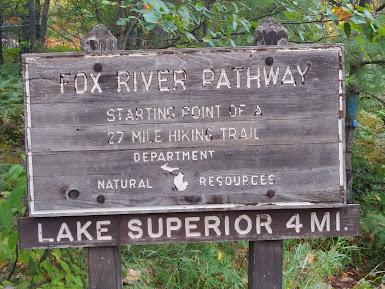 Read more: Fox River Pathway
Address: Countie(s) trail is located in: Alger Trail Type(s): Camping <> Hiking <> Road Biking Trail Measurement: 27.5 Miles Trail Distance: 27.5 Miles Directions: Pathway Directions to Trailhead: Kingston Lake SF Campground (H-58 or Kingston Lake Rd); Seney Township Campground (5 miles N of Seney on Co Rd 450) The Fox River Pathway is a…
-
Escanaba River State Forest
Read more: Escanaba River State ForestAddress: 46.15,-87.19 Countie(s) trail is located in: Menominee <> Alger <> Delta <> Marquette Trail Type(s): Cross Country Skiing <> Fishing <> Hiking <> Canoe/Kayak Trail Measurement: Escanaba River State Forest is a state forest in the central Upper Peninsula of Michigan. It includes forested lands in Alger, Delta, Marquette, and Menominee Counties. The forest…
-
Feldtmann Lake Trail
Read more: Feldtmann Lake TrailAddress: 47.8818369,-89.1778666 Countie(s) trail is located in: Keweenaw Trail Type(s): Hiking Trail Measurement: 8.5 Miles The Feldtmann Lake Trail is a trail located in Michigan. Isle Royal Windigo Guide References and More Info