Address: 46°24’13.5″N 88°43’22.5″W Ottawa National Forest (Kenton Ranger District)
Countie(s) trail is located in: Iron
Trail Type(s): Hiking
Trail Measurement: Roughly 3 miles (5.0 km) loop
Trail Difficulty: Easy to intermediate (or medium), featuring rolling, sandy terrain with a small degree of difficulty. About half a mile of the path has added gravel.
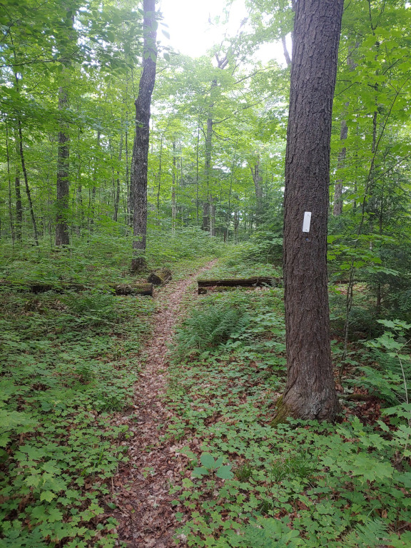
Ecosystem & Scenery: Takes hikers through pine forests and northern hardwoods directly along the shore of Deer Marsh.
Special Highlights: Includes interpretive signs, two wildlife viewing platforms, benches, and a puncheon bridge crossing a beaver dam.
Tucked away in the Kenton Ranger District of the Ottawa National Forest, the Deer Marsh Interpretive Trail offers an immersive three-mile journey through the quiet wilderness of Michigan’s Upper Peninsula. This scenic loop gently winds across rolling, sandy terrain and northern hardwood forests, hugging the edge of the marsh and showcasing vibrant local ecosystems. Hikers can rest on benches, read educational interpretive signs, and cross a unique puncheon bridge built over an active beaver dam. With two dedicated wildlife viewing platforms, the trail is a peaceful haven for spotting whitetail deer, ospreys, and beavers, which smoothly transforms into a serene cross-country skiing path when winter arrives.


I almost tripped over a massive pine root looking at a beaver dam here last October. My boots were soaked, the air smelled like damp earth and pine needles, and honestly, it was perfect. If you are tired of paved city parks with concrete paths and manicured lawns, pack your bags for Iron County.
The Deer Marsh Interpretive Trail is a three-mile loop hidden inside the Ottawa National Forest. It wraps around a massive, quiet wetland just off Sidnaw Road.
What the Trail Is Actually Like
Forget manicured gravel. Most of this path is just raw, rolling sand and dirt. Walking here feels like a real hike. You will weave through thick stands of northern hardwoods and massive pines that block out the sun.
The half-mile mark gets weirdly sandy. It feels like walking on a beach, miles away from any ocean. Local trail crews dropped some gravel on a short stretch to help with traction, but expect a minor calf workout anyway.
The best part? The puncheon bridge. It is a rustic wooden walkway built directly over a beaver dam. You can stand right in the middle of the marsh and watch the water line.
Quick Facts for Your Trip
- Length: 3 miles total.
- Time: Give yourself an hour or two.
- Difficulty: Mostly flat but lots of roots.
- Toilets: Vault toilets are at the campground trailhead.
The Wildlife Secret
Everyone talks about seeing whitetail deer here. Sure, they are around. But the real prize is looking up. Bald eagles nest near the water. Owls hang out in the deeper woods during the late afternoon.
I sat on one of the wooden viewing platforms for twenty minutes waiting for a bear. No bear showed up, but a massive blue heron landed twenty feet away and spear-fished for its lunch. Bring binoculars. Leave the loud Bluetooth speakers at home, or the animals will clear out before you even park your truck.
Getting There Without Lost Cell Signal
Cell service drops to zero out here. Download your maps before leaving Iron River or Crystal Falls.
Drive south from Sidnaw on Sidnaw Road for about 7 miles. Turn left onto Martin Lake Road (FR 2125). The dirt parking lot sits on your left. You can also start directly from the Lake Ste Kathryn Campground if you are tent camping.
Wear bug spray. The mosquitoes in July do not care about your feelings. Fall is the sweet spot—no bugs, crisp air, and the leaves turn bright orange.
References and More Info
- Compass Latitude: 46°24’13.5″N
- Compass Longitude: 88°43’22.5″W
- Numeric Latitude: 46.403750
- Numeric Longitude: -88.722917
- Elevation in Feet: 1,680
- Elevation in Meters: 512
- Trail Measurement: Roughly 3 miles
Leave a Reply